A convoluted walk around Colzeum
 Getting there: about 21 miles, 40 minutes.
Park considerately in the roads around ‘The Swan Inn’ in the village of Banton where there is a small shop.
There are various ways of getting to Banton but this route gives you a feel of where you will be walking. Take the M8 east from Glasgow, then the M80 towards Stirling etc. At the sign indicating Kirkintilloch/Stepps etc turn left to a very large roundabout with traffic lights. Turn first left off the roundabout and come down to a smaller roundabout where you go straight (second exit) up Initiative Road signposted Kirkintilloch. Follow this straight road crossing all roundabouts and ignoring all exits until you come to the A803 at major traffic lights. Turn right and follow the A803 (past the road to Twechar) through Queenzieburn and Kilsyth and past the signs and gates of Colzeum Country Park. Ignore the first road on the left and take the second left (at Kelvinhead) clearly marked ‘Banton’.
The walk
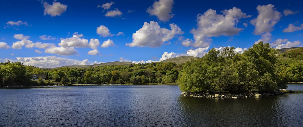
Take the Mill Road almost opposite ‘The Swan’ turning right along a sign-posted path which leads to Banton Loch. This very picturesque mill-workers’ path takes you into Colzeum (pronounced Coal-zee-um) Country Park. At the junction at the end of the loch, turn right and then left to follow a convoluted route along a canal feeder to a small bridge across the canal feeder. The path heads up towards the main House (where the toilets at the restaurant may be open). Continue past the restaurant and up a wooded glen around a magnificent waterfall, returning through a pets’ cemetery. Turn left (vehicular – take the pedestrian path across a bridge) then left again and right to go straight down along a pedestrian path over an ancient bridge and out on to the A803. Crossing carefully, start on a vehicular road but quickly enter a gate and go past boulders, an old bath etc to a gate and footpath on the right. This goes down to the ruined Craigmarlich House and out to a car park on the Forth and Clyde Canal. Turn left here and follow the canal to a sign-posted footpath on the left up to Kelvinhead and, crossing the A803 again, up to Banton. The total distance is about 7.0 miles.