All posts by Glenda A. White

A cobble around the River Forth

There are glenda-white-cobbled-together-walks and Mark II glenda-white-cobbled together walks and this one is definitely in the latter category. Indeed, wyou actually walk through Cobleland which adds to the convolutions. But it’s all astonishingly beautiful – even in misly-misty rain. You’re never far from the River Forth sparkling over rushy weeds, tumbling over boulders and overhung by berried trees. The forests are composed of deciduous trees of every hue and, so far, the weather has conspired to produce one of the most astonishing autumns on record. This is just the walk for it.

The total walk is only about 7.5 miles but it seems longer because of the twists and turns and both the kirk with its mortsafes and the Woollen Centre are likely attractions. The route, except for the very last bit, is flat-ish. A climb of Doon Hill isn’t included (you go round the base) but of course you may want to go up.  The LRTs are firm underfoot but even they, and especially the paths, can be slippery with rotting leaves. Some of the paths are also joyously muddy but nothing serious.

To get there

Stirling FK8, UK

Even getting to the car park is a bit of a cobble! You can either opt for the route through Drymen (the A811 which then joins the A81) or take the A81 direct through Milngavie, Strathblane etc. Assuming you can find your way going towards Aberfoyle on what eventually is the A81, take the first road signposted (left off the A81) towards Gartmore Village. Follow this road to the sign directing you right into the village street and go up past the picturesque houses and shops. At the top you come to the back entrance of Gartmore House which is on your right. You turn left with the road (the Cunninghame Graham monument is on your right across the green). The road now curves round sharply to the right and follows the back road towards Cobleland and Aberfoyle. Not far along this road is the signpost on the left to LEMAHAMISH CAR PARK. Unfortunately, the signpost which should face you is missing so you won’t see the signpost for those coming the other way until you’ve past it! If you drive fairly moderately you’ll see the LRT going into the forest.

The first part of the LRT is reasonably good. At a sharp bend follow the blue parking signs to the left and at the cross-tracks follow the signs to the right. This section is not so good and you’ll want to take it very slowly where there are potholes. Follow this track down to the river.

The walk

Begin by taking the path along the River Forth – going down to the river and turning left. This idyllic little gander brings you on to the LRT coming in from the left directly from the cars. At an obvious path and sign post for the footbridge, turn right and follow the track through the woods, up over the footbridge across the Forth and down to the cycle track. Counter-intuitively, turn away from the massive sign pointing towards Aberfoyle, going right on the cycle path.   Cycle paths are better for conversation than for walking but you soon come to the ‘pill box’ remaining from World War II. At the road, turn right again across the river and then right down into the (closed) Cobleland camp site.  Take the track going straight down and along the river and follow this through the camp site. A very good path hugs the river, and opens out at some picnic tables. (If you continue on you’ll come to your car.)

Leave the picnic area by taking the path on the right-hand side of an unnamed (and apparently unmarked) burn. The path heads up through the woods and comes out on the LRT that you drove in on. Turn left here and come back to the cross-tracks which you also drove to. However, now turn right and walk through the forest to ‘Easter Park’ which you ignore, continuing down to where the path around Doon Hill joins. You will see that you can avoid going around Doon Hill by continuing straight on. This will save about ½ mile.

You are going widdershins around Doon Hill and the path is a little harder to find and less well-walked from this ‘southern’ end. It’s not actually marked on the OS map. However, it follows the contours around the hill (which looks high from this point but isn’t!) until it joins the LRT coming in from the northern side. Just before you emerge back on to this LRT a clear path on the left goes up to the top of the hill. However, it’s covered with trees so there are no views but you may want to go up for the fun of it. The base path continues to the junction with the LRT which you left ½  mile before and where there is a sign explaining how the minister of the kirk in Aberfoyle was stolen away by the fairies. You now follow the LRT to the road, cross the bridge over the Forth and turn right along the river path to where a ‘Welcome’ notice encourages you to visit the Woollen Centre.

Back on the riverside walk,  follow this to the junction of a contributory burn where you turn left up to the cycle track. Once on the cycle track, turn right to begin the walk back to the car. The first part is fascinating as you see Aberfoyle from a completely different viewpoint. You can also see what the Parish Council has done with devolved monies – a play park, a cycle run and a wild-life area. Well done them! The cycle track continues to the large ‘Aberfoyle’ signpost which you rejected earlier in the day, and back across the bridge to the LRT track leading to the car. If you want to go straight back, turn left here and retrace your steps along the outward route.

However, there is one more lovely bit to do if you’re up for it. Turn right, heading for Easter Park, and a little way along, on your left, is a path leading up to Easter Park. This is the only climb (ish) of the day! At the top, turn left and come down a particularly lovely path through deciduous trees which eventually reaches the outward LRT. Here, turn right and the car will be in sight.


Dunkeld Circular

For this walk you will need to catch the 10.10 train from Glasgow Queen Street to Dunkeld There’s a return train at 19.18. The ‘Dunkeld Path Network Map’, obtainable from the Tourist Office in Dunkeld, or downloadable from the website, would be useful on this walk.

Begin your walk by crossing the railway line by the bridge and then turning left (with your backs to the station) going to the end of the platform and down the steps. You come to a road where you turn left, taking the off-road path above the road.  Go straight on following the ORANGE, INCHEWAN path alongside the Inchewan Burn which is on your right. This part is absolutely beautiful.

All too soon, you reach the junction with a path to the left, but go a little further on and, on your right and just in sight, is a rustic bridge across the Inchewan Burn itself. Once across, you leave the Orange Inchewan Path, which goes off to the left, and take a forestry route, marked with purple dashes on the Dunkeld Path Network map, across the Ladywell Plantation.

You come to the GREEN BRAAN path at a curious junction where you turn right. It’s sign-posted to the Hermitage which you’re making for. The Braan path goes down to cross a country road, past a car park on your left, then underneath the railway line, then over the River Braan and into Inver. You then emerge on to a fenced off-road path alongside the A9 but quickly reach The Heritage car park. If you’re lucky there will be a kiosk selling cakes, crisps, hot drinks and ice-creams (but no sandwiches or hot food).

Hug the River Braan for a beautiful walk along the river bank to the spectacular waterfalls and Ossian’s Hall at The Hermitage. This justly famous and exceedingly picturesque spot is good for lunch.

After visiting The Folly, (both doors will be open –  push hard) continue on up to Ossian’s Cave, but here leave the Green Braan path for the PALE PURPLE INVER route. After the beauty of the deciduous woods, this stretch along a LRT is less attractive but there are good views across the river to the hills beyond. The Inver Route winds down to the river where you should  ignore the path along a stream and under the road and railway, but turn right to emerge on a noisy, horrible bit along the A9. There is a very wide, safe, pavement, and the views up the river to Pitlochry are good. Fortunately, you soon reach the cycle track on your left which curves down and back under the bridge to continue on the other side of the river on the PALE GREEN FIDLER’S path.

You now have an easy walk along the River Tay, initially above the river, but just beside it as you begin to get nearer to Dunkeld. The last stretch is lovely as the cathedral comes into view. Keep to the river until you are guided past the cathedral (now on your right) to turn suddenly sharp right. Now you walk along the far side of the cathedral, go through the Heritage Scotland entrance (free) to the front of the cathedral where you’ll want to stop to take photographs and explore a little.  Then  turn left through the main gates and into the little town. If you don’t know Dunkeld, the white-washed houses, Mercat Cross and triangle are exceedingly picturesque. At the main road,  turn right to cross the magnificent Thomas Telford bridge.

Once across the bridge  continue for a couple of hundred yards to Little Dunkeld. A sign-post points left across a grassy triangle to the road to Birnam and you follow this to the Birnam and Dunkeld Hotel.

Now take the Orange Inchewan Burn path, opposite the Hotel and on the right of the Beatrix Potter Garden and the left of the Inchewan Burn. This brings you back to the steps going up to the platform and the train for Glasgow.

The West Highland Way: Crianlarich to Ardlui

This is a straight-forward walk along the West Highland Way from Crianlarich to Ardlui. For aficionados of the WHW, it’s good to be looking in the opposite direction for once, since most people walk towards Crianlarich. Your views will be down the Falloch Glen towards Ben and Loch Lomond.  And although you won’t think this at the time, apart from the climb up through the woodlands at the start, you are gently going downhill all the way!!!

If you are eating at The Ardlui Hotel afterwards, you will probably get permission to park at the car park on the left-hand side of the A82 at Ardlui Hotel NOT in the hotel car park. To get there, take the A82, Great Western Road, as usual, (Boulevard, Dumbarton, up Loch Lomondside). Make sure that you follow the A82 round to the right at Tarbet, rather than going straight on up the A83. Along this often twisting narrow road, note Ardlui Station on your left, the marina on your right, Ardlui Hotel on your right and a large layby on the left. If this is full, there is a large car park next left. Both of these areas belong to the Hotel and are not for public use.  There is a shop opposite the layby selling sandwiches and drinks etc. There are excellent toilets at Firkin Point and Tarbet and you would be best to use these. There are toilets on the train but you only have one stop! There are toilets at Crianlarich but they are slightly off your route.

Arrochar G83, UK

Begin by walking back down the road from the car park at Ardlui towards the station. There is an excellent off-road path for walkers although crossing to the station is awkward. The journey lasts 16 minutes and you get out at Crianlarich. A set of steps leads directly on to the road and the WHW is signposted to the left. You begin with a climb up on to the path since the WHW officially by-passes Crianlarich. Take this very gently: the path is good and there are no steep climbs but it does go on a bit. At the top, take the WHW towards Glasgow (NOT Tyndrum!). Then follows an idyllic seven miles on an excellent track looking up at Ben More, across to the Old Caledonian Forest and down the Falloch Glen. At one point there is a sharp turn to the left, taking you steeply down to an underpass underneath the A72. There follows some really pretty bits along the river although you hear rather than see the Falls. Derrydoch Bridge is delightful! The path is universally good underfoot, varied but busy. Simply follow all the WHW signs.

At Beinglass you might want to stop for a drink, ice-cream whatever, along with about 3,946 others!!!! If you want to leave here, you could take the bus. The bus is either No. 914/915/916 and runs from the Drover’s Inn to Ardlui Hotel (about 5 minutes) at 14.40 15.40; and 16.40.

Otherwise you plough on for another two miles, making 9 miles in total. The last two miles are quite tough!

At the ferry at Ardleish, the fun begins!!! You need to hoist the orange buoy! The sail across Loch Lomond is lovely! The fare is currently £4 per person. Remember to lower the buoy before you cross. You arrive back at the Ardlui Hotel.

The Three Lochs Way above Garelochhead

Again, this is the simplest of walks beginning and ending at a (very large) car-park. The full length is about 9 miles but those not going over Tom Buidhe can turn back whenever they feel like it and make for the Hotspots of Helensburgh. It will be obvious from the drive to the starting point that the car does all the hard work on this walk, although ‘The Yankee Road’ which you follow there and back, undulates a bit. If you ignore Faslane below the car park and the Military area on your right, the great advantage of this walk is the (hopefully) wonderful views of Gare Loch, Loch Long and Loch Goil and the even more spectacular views of the Arrochar Alps: Ben Ime, Ben Narnain and Ben Arthur (The Cobbler). There are lots more knobbly bits like Caisteal Dubh and Beinne Raithe. Never mind the names, the overall views are lovely and with easy walking you can actually look at them! The surface is too good at the beginning (metalled), and very good throughout. This is yet another section of Three Lochs Way!

Your turning point is the iconic wooden hut where the men slept who built the “Gurkha Bato”, a road constructed in 2009 by the men of 70 Gurkha Field Support Squadron to provide a route across the dangerously boggy ground just south of the railway underbridge. The new bridge across the Glen Mallan Burn bears a small plaque in memory of Dave Markland who did the early project management work on the “Gurkha Bato”, Sadly, Dave lost his life in Afghanistan not long after.

Park in the ample space on the ‘Yankee Road’ over-looking Gare Loch

For once these notes start by suggesting how NOT to go! If you set your Sat-Nav for Garelochhead it will, quite rightly, take you up Loch Lomondside, ignore the A818 to Helensburgh, but take you on to Shemore to the A817. This new road, built by the Americans when enlarging Coulport, is more direct, more beautiful and lands you right at the start of the walk. Unfortunately it also by-passes two sets of toilets which, since there are no toilets on arrival, are pretty necessary!

So, don’t use your Satnav but take the A82, (Great Western Road) as usual, (Boulevard, Dumbarton, up Loch Lomondside). Beyond the huge roundabout with the flying geese (or whatever?)  at Balloch, continue on up past the Duck Bay Marina and then at the next roundabout, at Arden, turn left on the A818. This good road takes you to a roundabout where you turn left continuing on the A818. You’ll come into Helensburgh, go straight down the hill, across the A814 (the Shore Road) and into the huge pier car-park. Turn right in the car-park to go in front of the Swimming Pool. The toilets are very obvious in front of you, just where you’ll exit back on to the A814.

Exit from the car-park on to the A814 and turn left along the front in Helensburgh. Continue through Shandon etc. to Rhu where there is another toilet block on the seaward side and a small bus bay where you can park. The continue past the Peace Camp on your right and Faslane on your left.

At the roundabout with the High Security entrance to the Naval Base on your left, and Garelochhead and Kilcreggan straight on, DON’T go into Garelochhead. Instead take the third exit on your right, signposted to Arrochar.

At the next roundabout, ignore the road to Arrochar and Coulport on your left and take the right-hand road signposted Balloch with a huge brown Tourist Board sign pointing to Loch Lomond.

Drive up and up and up this road and when you see a sign on your left saying “Cross Roads’ and ‘Danger Military Vehicles Turning’ and a big exclamation mark, slow down and turn left along an open tarmac road. Ignore the first space, go through the gate (I think it’s a gate) and park along the left-hand side looking down on Garelochhead and Loch Long. This is probably the most beautiful car park we’ve ever parked in!

Helensburgh G84, UK

The walk

Simply set off along the metalled track, high above Loch Long and always looking towards the mountains. After about two miles, the tarmac ends at a gate and you’re on to much more pleasant walking, still easy, but with earth beneath your feet. At a pleasant junction, the main path goes straight on but those who would like to climb higher turn right here and go over the side of Tom Buidhe. There are good views from the top –including The Sleeping Warrior on Arran.)

On the way down, DON’T take the path to the right, signposted Arrochar along the Three Lochs Way. This is too far for one day. Instead, turn left and go down very steeply to the unmistakable ‘Gurko Bato’. If you have continued on the LRT, ignoring Tom Buidhe you may turn back here ; or you may go on a little to wave your red flannel petticoats at the trains which are just below you. You can get nearer to the trains where an alternative (and very-muddy-on-the-reccé-path) goes under the railway!

Burncrooks Reservoir and the John Muir Way

This is the simplest of walks beginning and ending at a (very large) car-park with toilets and following well-sign-posted routes (excepted where I’ve cobbled together extra stuff) along the newest section of The John Muir Way (JMW). This section used to follow the road but has been developed at a cost of half a million pounds so wear your best boots! The new route comes in from Balloch but, given the limitations of a circular walk back to the cars, you can do an extended loop from Edenmill Farm car-park. This is an unexceptional walk although Burncrooks Reservoir is pleasant and the views of the Campsies, the Kilpatricks and the Arrochar Alps from parts of the path are lovely. The two reservoirs are also pretty enough. The walk back looking across at Glasgow no more than 5-6 miles away is astonishing. There are two opt outs, allowing you to get back to the café for an extra cup-of-tea! The full length is just under 8 miles on mainly level paths.

Park at Edenmill Farm car-park

Take your favourite route to Canniesburn Toll (either Maryhill Road (A81) or Great Western Road, Anniesland, Switchback Road. At Canniesburn Toll, make sure you take the Bearsden/Drymen Road (A809). Drive up to and through Bearsden Cross, turn right, still on the A809 now called Stockiemuir Road (at what used to be Notre Dame College and is now St Andrew’s Brae opposite the Ski slope). Continue through two sets of traffic lights, across two roundabouts (Baljaffray and Crossburn), through Craigton and past the Hilton Golf Course. If you glimpse signposts for the JMW on your left just before Carbeth Inn ignore them. Go past Carbeth Inn and the junction with the A821 to Blanefield.

With Auchengillan Outdoor Centre on your right, turn left directly opposite clearly marked Edenmill Farm Shop, Christmas Trees, café etc.  It is marked on the OS map as Auchineden Farm and there is in fact an old name to this Farm at the entrance.

Drive along this picturesque, single-track road with passing places and, at a notice saying, PRIVATE, NO VEHICLES, turn left into an enormous car-park.

 The walk

Just to be awkward ignore the John Muir Way which comes into the car-park from the south (your left facing the café) and goes out on your north west (behind you at the corner where you drove in.) Or vice versa if you’re walking the other way! It’s surprisingly difficult to get this sorted despite the foot path signs. (If just want to do the JMW around the reservoir then go to the entrance/exit of the car park go back a little way along the road you came on, but turn sharp left through the PRIVATE, NO VEHICLES sign and follow the JMW signs.

On this walk, however, facing the café turn left across some scrub land and then right as sign-posted. At the T junction of tracks sign-posted ‘Carbeth’ to the left, immediately turn right, in the opposite direction from the John Muir Way and follow the LRT. At a junction, ignore the path to the left to a huge wooden building and go straight on past the picturesque cottage called South Lodge. Keep to this LRT, ignoring any turn-offs, till you come to the main ‘road’ going straight up to the reservoir. The advantage of this route is that it keeps you off tarmac for a little longer, has pleasant views and the gentle gradient is even gentler!

At this ‘main’ road, turn left, now on the official route, and continue up past the filter station to a left turn with huge Forest Enterprise warning notices. The JMW turns left here but  you can go straight on which allows those wanting to opt out early to do a little turn around the dam and come back. This track goes past the path up to The Whangie and Auchineden Hill but you continue to the dam across the reservoir. Just before the dam there is a path down to a secluded second, smaller dam and a little glen. This is a picturesque sheltered spot for lunch. Up the other side of the glen turn left on the official JMW route coming in on your right from Balloch. This turns back to the other end of the main dam and there is a muddy local path from the path to the dam. Anyone wanting a short cut back can circle round here.

Otherwise you simply walk around Burnbrooks Reservoir. The views of Loch Lomond on the one hand and the Kilpatricks with Duncolm on the other are pleasant in either direction. This section is surprisingly lumpy!

Come back to the official exit/entrance of the JMW which you ignored on your way out.  Turn up the LRT to a T junction. If you’ve had enough, turn left here, and at the next T junction with the Forest Enterprise Notice Boards, turn right and go back down the road, past the Filter Station. This time, don’t go round South Lodge, unless you want to, but continue down the road to the little hamlet of Auchineden. Go past the bungalow on the left, turn sharp right, following JMW signs, and into the car park.

However, if you have time, turn right on exiting the path from Burncrooks Reservoir. At a junction, take the left hand turn past the quarry. This LRT curls round to Kilmannan Reservoir which is quieter and perhaps prettier than Burncrooks. On the map the track stops at the dam, where there are lovely views. However, the track clearly goes on and there are plans to develop a path all the way round. Return from the dam the same way and join the route taken above back to the cars.

Ayr circular: A brisk walk along the front!

The promenade and cycle track are metalled, and the remainder of the paths are firm and well-beaten. Note that the path around Greenan Castle may be tide-bound if it’s a particularly high tide but there’s a clear inland route either just before the castle, which joins the cycle way, or up and over the castle.   That’s all the bad news! Otherwise, this is a lovely stretch along the sea front, beginning a few yards into ‘The Lang Scots’ Mile’ and making for the most romantic ruin of Greenan Castle. At the very start, Ailsa Craig is just in sight, soon to be hidden from view by the Heads of Ayr. You should see Arran and Holy Isle and you could have lunch at the Burns museum before following a most attractive path down Slaphouse Burn and through Rozelle and Belleisle Parks back to the seafront.

Park either at the Cromwell Road car park at the north (River Ayr) end of the promenade or anywhere along the promenade.  There are toilets in  Pavilion Road at the start of the walk and, in summer, by the Indian Restaurant.

Ayr, South Ayrshire, UK

To get there

Begin by taking your favourite route to the Kingston Bridge and the M77 where it’s a straightforward journey down the M77, following the signs to Ayr, to the Prestwick Roundabout, (take the dedicated lane to Ayr on what is now the A77); on through the next roundabout to Whitlett’s Roundabout. Here there are eventually four lanes, two outer (on the left) going on to Stranraer and two going half-way round the roundabout towards the Ayr Town Centre. The two lanes going towards the Town Centre take you down Main Road/ Whitletts Road/King Street but there are parked cars on the inner lane so  keep in the right lane. Go past the new race course, straight on at the traffic lights at Craigie Road and down to a huge roundabout with the A79 with TK Max in the corner. Go straight over here and down King Street to what is actually a T junction but you wind left across the bridge over the River Ayr and along the Sandgate with shops on either side. Continue over an awkward roundabout until you see Wellington Square on your right with a War Memorial Garden and the Council Offices beyond. Go on down past these imposing buildings to the sea front. Just past ‘The Pirates Ship’ on the left are the Pavilion Road toilets. If you don’t need these immediately, turn right along the sea front and then third right, just past the Horizon Hotel. This is Cromwell Street. Turn left into the car park. This may be full on weekdays but emptier on Saturdays and Sundays.

Your walk begins by getting on to the sea front where, depending on where you’ve parked, you’ll pick up the ‘footprint signs’ for ‘The Lang Scots’ Mile’. Greenan Castle looks some distance away but, in fact, it takes no time to reach the ‘new’ bridge across the River Doon.

Try to walk along the sea edge here – maybe even around the castle itself , but if it’s a very high tide, you may have to keep inland. In this case, the path you need goes off to the left just before the path takes to the shore around Greenan castle. An old cottage is clearly visible directly in line with the path.  Within 20 metres you will come to a mesh fence which is easily crossed.  Go straight ahead towards the cottage and after 10 metres the path will be clearly visible.  At the cycle track turn right and you’ll come to the route below.

However, If you’re doing this at low tide, keep walking right around the castle to the little cove where the Deil’s Rocks point out to sea and find a good track going up on the left towards Greenan Farm. Take the track up towards the farm, and then on to the A719, turning right where the cycle track forks. A dog-leg to the left takes you across the road and on to the old railway which runs for 1½ miles through not unattractive countryside. You might want to leave it at the Burns Museum possibly to eat but also for toilets.

After a break here, follow the road for a few yards to regain the old railway to Maybole Road where you turn left, again for a few yards. Just before Slaphouse Burn there’s a wicket gate leading on to a lovely path beside the burn which you follow, across Loaning Road, and on to Rozelle Park. You can divert left here to follow the track down to Rozelle House (with a toilet with a radar key) and pop into a little sculpture park on the left, and duck ponds on the right (just to get full value) before exiting through the main entrance on to Monument Road.

Here you turn right and then left into Belleisle Park. At the main house turn right to follow the path past the temporary café. You’ll come to a fairway. One way or another you have to cross over to the boundary wall beyond. If there are no golfers on the fairway go straight across. If this looks dodgy, turn left on a good track and where the fairway narrows, cross to a path beside the wall which runs back up to the right through a line of trees.

Either way follow the path to the old race course and go right round emerging on Racecourse Road. Continue down to the sea front the toilets at Blackburn Drive. After that, it’s a slog along the promenade to the car!


Selkirk to Melrose

Again, this is a linear route so you will either need to use a taxi or a bus to bring you back to the start. It may be preferable to leave your car in Melrose, having arranged for a taxi to take you to the beginning of the route in Selkirk described below. This leaves you free to take your time since you are walking towards your car. If you are using a bus, you need to begin the walk in the town centre of Selkirk. If you are walking the Borders Abbeys Way then, of course, your route will take you across the A699 and continue on to Buxton.

If you are starting at Selkirk, however, it’s a long walk from the town centre and you may prefer to leave your car at a convenient small car-park on the A699 by the golf course and then use the ‘Selkirk Pathways’ (marked with a yellow triangle). Cross the road from the car park to the artificial footpath and then turn immediately right on a proper path to enter woods. This parallels the road, inside the woods and high above the golf course. The path turns sharply left and then steeply downhill, crossing a tiny burn by two planks, Continue across a golf green on the right hand side and pick up a good path again. This exits the golf course at a kissing gate. Here there are two paths, both with yellow triangles. Take the yellow triangle path to the left, which initially follows the bottom part of the golf course. Now keep following the yellow triangles across Selkirk Common. You should keep flat (avoiding any paths going up!) and veering right at every junction except the last one when you turn left. You should pass what was the old skating pond and cross several little bridges. Unless you are lost you should see the large house at Buxton, cross a substantial bridge, turn sharp right and come down to a good track through a gate.

You emerge on the BAW proper, now with BAW symbols, turning right along a delightful lane. An initially gradual climb along the track brings the Way past the side of Bell Hill and up towards a farm at Greenhead. Instead of having to pass through the farm yard the route turns left off the track and round the edge of two fields before reaching the minor road at Shawmount. Just before exiting at Shawmount there are panoramic views back over Selkirk and into the Ettrick Valley so it is a good point to catch your breath. This section is un-pathed and unpaved and muddy but a real country farm with sheep ‘n stuff! Emerge on a country road where you turn right and begin to gain height over the next mile or so to climb up Selkirk Hill. This part is a pain until you reach Lindean Moor Farm and Halfcrown Corner from where the remainder of the walk is idyllic and not to be missed.

‘On the left and below in the valley is the little community of Lindean. It was in this community location that Selkirk Abbey was built in the early 12th century, but it did not remain for long and the Monks chose to re-establish themselves in more fertile lands at Kelso. On the right is the Lindean Mast beaming television signals to the Central Borders’ community. To the side of the mast on the roadway there are more attractive views, now opening up the countryside to the north and northeast. To the west the views are up the Yair Valley and towards the Tweeddale hills.’

Near the TV mast you’re directed left down a lovely lane past some astonishing sheep, straight over a yellow road, and then up just a bit because you’ve done the real climbing. The old drove road is level-ish until you go down to Abbotsford. The views, particularly to the south, are wondersome.

Just as you approach a hill, with an obvious path going up and over, you discover that, oh frabjious joy, you’re going around! And just as you go around – the Eildons appear, plonked on your right-hand side. They are close by and viewed from an unusual angle with Eildon Wester Hill in the foreground and Eildon Mid Hill beyond and Eildon North Hill, the one which normally dominates the scene, beyond that.

As you leave the overwhelmingly photoesque Eildons and Cauldshiels Loch the BAW goes off on the right and then takes to the road for about two miles. To avoid this road walking you might like to take a glenda-white-route on what is, in fact, a come-and-go-occasionally-waymarked path. At Upper Falconside, where the road turns right, and a driveway turns sharp left into the farm, take the track at ‘ten-to’ down past past Faldonside Loch (beautiful). Then take an obvious track to the right which on the map appears to go nowhere. It’s sign-posted with a yellow triangle and climbs uphill. At the top, don’t curve round with the track but continue straight on to the right of a fence and a wooded gorge. (At the top there is a stile over the fence. Ignore this.) Go steeply down, occasionally finding both a path and a yellow triangle and, when in sight, make a five-bar gate. Don’t go through this but go further to the right to exit via a kissing gate, down a path and on to the road (the B6360). Dog-leg to the right over the road and enter the Abbotsford Woodland Walks. Here go right to follow a good path until you reach Scott’s House and Garden. Don’t enter the courtyard, but keep to the exit on the right and come out past the restaurant and back on to the BAW proper. You may want to use the toilets and have a quick look around the shop and exhibition, both free. There is also a restaurant up the stairs.

Abbotsford to Melrose

Note that this section is joined in places by The Walter Scott Way, The Southern Upland Way and the St Cuthbert’s Way. A thistle within a hexagon is the sign of a Scottish National Trail. Any yellow triangle means that the National Trails are also, at this point, public paths for local walks.

This section begins at the restaurant/gift shop. The path runs vertically from the B6360, between the car park and the restaurant, and continues down to the River Tweed. Turn left or right depending on whether you’re coming from the restaurant or the car park and follow the sign-posted way towards the river. Just before the river, turn right (sign-posted) along a tree-lined path. The path undulates slightly until you quickly reach the A6091 above and a modern bridge across the Tweed. Here the path goes under the bridge on decking then up the other side and round a side of the Tweedbank community.

Safely under the road, the path continues beside the river to Tweedbank. The path follows the river (at one point across a rickety-bridge) until it reaches the old railway line. The path passes under an arch of the old railway line bridge, and then quickly returns to the river bank. The walk curves to the east (right) passing by Lowood House before temporarily leaving the banks of the river to come onto the Lowood House drive, crossing a public road at the “Bottle Bridge” and again regaining the riverbank behind the Bay Waverley Castle Hotel.

The path opens out to to a broad track beside the river. There’s a slight climb just before Melrose up to the church, before returning to the river. Go past (NOT OVER!) the Chain Bridge and turn right up the Annay Road to the Abbey.

South Queensferry to Cramond return

What with two and a half iconic bridges, Robert Louis Stevenson’s ‘Hawes Inn’ which is mentioned in ‘Kidnapped’  and the islands of the Forth (Inch Garvie, Long Craig, Inchcolm, the Cow and Calves, Inch Mickery and Cramond Island itself) this is a most photogenic walk. If you have never been to South Queensferry you’re in for a treat just driving through the cobbled streets: throw in Dalmeny House from several angles, Hound Point and Barnbougle Castle,  a couple of picturesque cottages  and the view of Cramond from the beach and you have a perfect day.  It’s very easy walking on LRTs and lovely paths beside along the shore all of which are firm packed. The round trip is 9 miles but  you can turn back at any point, lie in the sun, or go for a coffee in South Queensferry.

 Park in the car park facing the River Forth, at the far end of South Queensferry, almost underneath a stanchion of the rail bridge and just before The Hawes Inn (highly recommended!). As you leave the cobbled winding streets of South Queensferry behind, enter the car-park on the left – it’s one-way. There are toilets opposite.

South Queensferry, Edinburgh EH30, UK

To get there: Satnav Post Code: EH30 9TA for The Hawes Inn
Getting there is very easy until the last 3 or 4 miles! The mileage and timing seemed about the same which ever route you take  at about 55 minutes and 44 miles, although  (as of May 2016) there are road works on Route two – the M8. In any case Route One is easier to follow with wonderful views of the new bridge.

Route One:
Take the M8 east (towards Edinburgh) from Glasgow and then the M80 to Stirling, Kincardine Bridge etc. After about 15 miles take the M876 to Falkirk, Grangemouth etc. DON’T TAKE THE FIRST M9 GOING OFF TO THE LEFT – this is the wrong direction. Stay on the M876 and then move over on to the M9 while the M876 goes on to Kincardine Bridge. (You’ll hardly notice that you’ve now joined the M9.) Stay on the M9 for about another 15 miles until Junction 2 with the B8046, when a brown tourist notice takes you left, advertising Hopetoun House. At the end of the slip road turn left on the B8046 and at the T junction, turn right on the A904. Drive for about 4 miles through Winchburgh, Newton etc, Almost immediately after an elongated roundabout turn left on to the B924 to South Queensferry (Bo’Ness Road then Hopetoun Road) which goes underneath the motorway above. Continue to follow the B924 (Hopetoun Road) through the outskirts of South Queensferry. At a very awkward junction, turn left onto Newhalls Road (still the B924) which ducks and weaves through the town.

Route 2:
Take the M8 towards Edinburgh but stay on the M8 for about 37 miles until you reach the M90/M9 signposted to the Forth Bridge (A90), Stirling (M9). Watch that the slip road comes up on to the M9 rather quickly. Continue on the M9.

At Junction 1A take the A90 exit signposted to Perth and Dundee. This is a huge curve round to bring you down on to the the M90 below. Continue on to M90.  Continue to a very large roundabout where toll traffic for the bridge goes straight on.  Go right round and take the third exit, B800, Ferry Muir Road, towards Kirkliston. At the next roundabout take the 1st exit on to Kirkliston Road, B907. Continue to follow the B907 down past Dalmeny Station etc. At a very awkward junction, turn right onto Newhalls Road (B924) which ducks and weaves through the town.

The Walk
Your walk is simple! From the car park  continue in the same direction, past the pier for Inchcolm on the left, and The Hawes Inn on the right (dating back to the 17thc.), and the Forth Rail Bridge above (completed in 1890)! Don’t go up the hill with the road but hug the shore line with fantastic views of the three bridges.

The first quaint white-washed building on the left was once a World War I gun emplacement, then a tearoom and is now an office. With woodland on your right and the river on the left you soon enter the Dalmeny Estate and approach Long Craig Pier which used to be one of the ferry crossings across the Forth. (There were several such piers and crossings depending on the tide.) It might be worth doing this to take photos.

Go through the white gate beside ferry cottage as you continue towards Hound Point. Just before, at Peatdraught Bay, is the first delightful alternative. At a clear junction with three huge tree-trunks,  take the firm path to the left down nearer to the shore and into a grassy knoll. This is lovely. It re-joins the main track at five huge tree trunks which you should look for if you want to take the diversion on the way back.

The Estate notes say: ‘It is worth taking a detour onto Hound Point headland, which, according to folklore, is haunted by a dog owned by Sir Richard Mowbray who died on the Crusades. The views from Hound Point are magnificent. There are numerous points of interest including Inchcolm Island with its old abbey and the Forth Bridge. Opposite the turning to Hound Point and up the hill within the woodland are the remains of World War I gun emplacements, part of the Forth naval defences.’

Continue past Fishery Cottage (so-called because salmon was fished from here until the 1950s). The next significant point is Barnbougle Castle, restored and privately owned. And difficult to photograph from here – there are good views looking back from further on!!! Again, the Dalmeny Estate notes say: ‘Barnbougle Castle may be glimpsed through the trees. The castle is on the site of a medieval tower house built by the Mowbray family which was destroyed and then rebuilt in the 19th century. At Barnbougle the fifth Earl of Rosebery (Prime Minister) practised his speeches in a gallery hall built for the purpose.)’

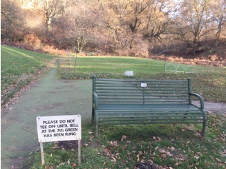
 Just beyond Barnbougle Castle  you come to a golf course and your first view of Dalmeny House. (The view was excellent but even better on the return leg.). At the corner, unexpectedly, and with the main notice lying on its back, is a John Muir Way signpost showing that cyclists should continue on the road but walkers should turn sharp left to walk along the river. This is a wonderful improvement. The path goes straight down to the river (and a lovely tree trunk to sit on) then sharp right along the river bank. At the end the path continues through the woods going slightly inland to cross the briskly flowing Cockle Burn on a sturdy footbridge beside a rotting seat! The path emerges on a track beside some picturesque cottages (Long Green Cottages which were built for estate workers) and then continues on to rise slightly with lovely views of Snab Point, the river and Arthur’s Seat. There is a huge boulder here where you might stop for lunch. Continue on to Eagle’s Rock and then come to a full stop!

The way ahead and around Cobble Cottage is blocked but it is worth taking to the beach at this point just to look at Cramond. Unfortunately, at the time of writing, there is no way of getting across the River Almond. After viewing the river(s) and the village, return to the sharp turn in the path where the John Muir Way turns sharp right and you went left on to the beach.

Follow the JMW uphill a short distance and take the JMW cycle route inland but higher up. This is well worth doing, not least for the better views of Arthur’s Seat and even across to Scald Law and the Pentlands. This path comes to a crossroads with lots of alternative walking routes. But you may as well stay with the JMW through Long Green to the Estate Road going down to Dalmeny House. There are spectacular views of the house.  Again, the notes say: ‘From the golf course there are beautiful views of Dalmeny House which was built in 1817 to a Tudor Gothic design by William Wilkins. A rare type of artificial stone called Coadestone was used in the more decorative elements on the house such as the finials and panels on the façade. The house was used as an auxiliary hospital during WWI and during WWII the stables to the rear were used by the Army for a Barrage Balloon Unit. The house was damaged by fire during WWII, evidence of this can be seen in the use of a new copper roof on the southern wing of the house.’

Here re-join the outward stretch and retrace your steps to South Queensferry.


Walking at lambing time

It is probably best NOT to walk at lambing time but occasionally you might  unexpectedly come across the sweetest little bundles of wool with pink ears and knobbly legs you’ll ever encounter!! From April to early June some ewes may even be in lamb.  Despite their appeal, however, they are other people’s livelihood.

PLEASE do not go near the lambs, for example to take photographs. Never touch them – you will leave human scent on them and the ewe will abandon them. Don’t come between the ewe and her lamb for the same reason – the wind will carry your scent on to the lamb. Don’t stop to watch for too long – the wind is blowing! Leave the shepherd and the ewe to sort out any apparent problems, for example being stuck on wire or in apparently dangerous places.  You can only make matters worse and, surprisingly enough, shepherds are quite good with sheep! It is very unlikely that a lamb is dead – and if so, the shepherd will pick it up.  Don’t speak to the ewe – even to mimic a baaing sound – unknown human voices are distressing.  Please give ewes and lambs time to get ahead and off the track before coming close.  Always wait for the lamb to find it’s mother – if the lamb doesn’t follow immediately, the ewe will come back for it.  And please close gates if the next group is some distance behind. Each group will have to open and close the gates for themselves.  And don’t have lamb chops for lunch!!!

We are very grateful to all those who make their living in the countryside. Whatever the law says, we shouldn’t abuse their good will.