All posts by Glenda A. White

Glasgow Waterways and Sighthill

Starting Point for the Walk:

At the end of Dalsholm Road which is past the Dawsholm Recycling Centre – OS Reference  NS 557 696.  There is free on-street parking.

Getting there: 2 miles/ 10 minutes

From the Byres Road junction with the Great Western Road turn left.  Turn right at the second set of traffic lights into Cleveden Road.  Keep straight on at a roundabout and down a steep hill to cross the Forth and Clyde canal.  Having crossed the canal, take the first exit (Dalsholm Road) at the roundabout and cross over the railway line.  Continue on Dalsholm Road, ignoring the road coming in from the left.  However, be careful.  Whilst you have the right of way those coming from the left may not think so!  Continue onwards (past the Dawsholm Recycling Centre on the left) to the end of the road.

The Walk:  Glasgow Waterways and Sighthill – 9.3 miles (15 km)

The walk follows the River Kelvin south and at the Kelvin Aqueduct joins the Forth and Clyde canal and goes eastwards towards Stockingfield Junction.  Admire the impressive new bridge.  Explore the site and observe the massive concrete whale which will be tiled during the next few years by tiles designed by Glasgow school children. Continue on down the Forth and Clyde canal spur towards Firhill.  Toilets are available at the Tesco store on Maryhill Road opposite Ruchill Street, which is a short distance from the canal.

Picking up the canal spur again, go south towards the city.  Continue past Firhill, of Partick Thistle fame, in the direction of Port Dundas (the end of the canal).  Note the impressive lock system and then marvel at the Victorian ingenuity of building major docks in the centre of the city – now reduced to a Water Sports Centre.  It is now possible to continue on into Sighthill Park (which has been moved from its original location) and reconstructured further away from the town.  The stone circle has also been moved to be a centre piece for the North Bridge housing complex.  Lunch can be taken here and the park can be explored further for anyone who wishes to do so.


Retrace the route back to Port Dundas and then return via the other side of the canal as far as possible.  Then cross the canal again and continue on the west side.  Continue up the canal to the Stockingfield Junction and turn left back onto the Forth and Clyde canal.  At the Kelvin Aqueduct leave the canal and follow the Kelvin River northwards back to the starting point.

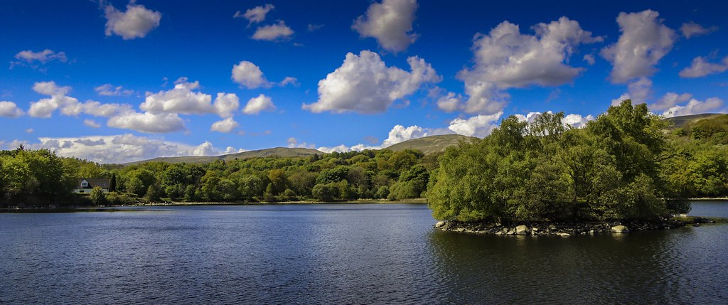
Burncrooks Reservoir

This walk is similar to a circular “summer” route traversed about 8 years ago. The main difference is that this time we will cover the route in an ‘anti-clockwise’ direction – and being in the “spring”, the walk should look sufficiently different from the previous version!

Starting from Edenmill Farm Shop (near Carbeth), we join the John Muir Way and follow it in a westerly direction for about 4 miles. In due course the path climbs through Forestry Commission land which eventually leads to Burncrooks Reservoir. The path around the Reservoir has plenty of good views – weather permitting! After traversing the Reservoir, we follow a forest road in an easterly direction which eventually brings us back to Edenmill Farm Shop.

Barr Castle and Lochwinnoch Loop

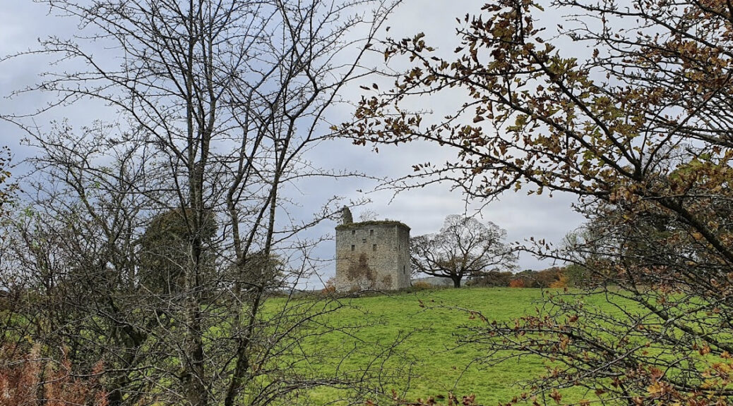
This walk starts at Castle Semple Loch in the Castle Semple Country Park. The park is part of the much larger Clyde Muirshiel Regional Park. The regional park covers 280 km2. The walk makes use of quiet back roads and cycle tracks. There is a ruined “castle” which dates from the 16th century which can be seen but not accessed.

Starting Point for the Walk:
The car park at Castle Semple Country Park – OS Reference NS 356 589.

Getting there:
By Train – 25 minutes
There is a regular train service from Glasgow Central to Lochwinnoch.  It is a ¾ mile walk from the station to the Starting Point.

By Car – 20 miles/32 minutes
Take your favourite route to the M8 Westbound towards Greenock.  Once on the M8, prepare to exit at Junction 29, onto the A737 [Irvine] (that is immediately after the Glasgow Airport exit).  Continue on the A737 until the Roadhead Roundabout and take the 3rd exit onto the A760 towards Lochwinnoch.  Pass the station on the left, just over the railway bridge, and the RSPB Reserve on the right, and after less than a mile turn right onto Lochlip Road.  Continue straight on until you see the Castle Semple Country Park sign and turn right into the large car park.  There are toilets in the car park (but these are sometimes closed) as well as in the Visitor Centre at the end of the car park.

The Walk:  Lochwinnoch/Kilbirnie Loop – 8.9 miles (14 km)
The walk is on small back roads, and cycle track so is not muddy.
Head out of the car park and turn right into St Winnoc Road, pass under the bridge and then take the second left into High Street.  Continue down High street and take the second right into Calder Street.  Continue up Calder Street past Lochwinnoch Primary School and turn left to cross the small bridge.  Having crossed the bridge turn left again.  This is a continuation of Calder Street – a little confusing!  Take a right turn at Lochwinnoch Golf Club into Corsefield Road. Continue along this road through all the ups and downs, and ignoring turns to the left and right.  There are lovely views to be had over the Garnock Valley on a clear day.  There are also a number of interesting small holdings and farms along the way.

On approaching Kilbirnie, the name of the road changes to Dipple Road.  Continue on until the junction with Stoneyholm Road (A760).  Carefully cross the A760 and follow the signs for the cycle track.  The return route uses the cycle track with the lochs on our right hand side.  This section of the route affords lovely views over the lochs.  On the outskirts of Lochwinnoch follow the cycle route signs which lead back to the car park at Castle Semple Loch, the starting point of the walk.

A circuit of Loch Banton

A  convoluted walk around Colzeum

Getting there: about 21 miles, 40 minutes.

Park considerately in the roads around ‘The Swan Inn’ in the village of Banton where there is a small shop.

There are various ways of getting to Banton but this route gives you a feel of where you will be walking. Take the M8 east from Glasgow, then the M80 towards Stirling etc. At the sign indicating Kirkintilloch/Stepps etc turn left to a very large roundabout with traffic lights. Turn first left off the roundabout and come down to a smaller roundabout where you go straight (second exit) up Initiative Road signposted Kirkintilloch. Follow this straight road crossing all roundabouts and ignoring all exits until you come to the A803 at major traffic lights. Turn right and follow the A803 (past the road to Twechar) through Queenzieburn and Kilsyth and past the signs and gates of Colzeum Country Park. Ignore the first road on the left and take the second left (at Kelvinhead) clearly marked ‘Banton’.

The walk
Take the Mill Road almost opposite ‘The Swan’ turning right along a sign-posted path which leads to Banton Loch. This very picturesque mill-workers’ path takes you into Colzeum (pronounced Coal-zee-um) Country Park. At the junction at the end of the loch, turn right and then left  to follow a convoluted route along a canal feeder to a small bridge across the canal feeder.  The path heads up towards the main House (where the toilets at the restaurant may be open). Continue past the restaurant and up a wooded glen around a magnificent waterfall, returning through a pets’ cemetery. Turn left (vehicular – take the pedestrian path across a bridge) then left again and right to go straight down along a pedestrian path over an ancient bridge and out on to the A803. Crossing carefully, start on a vehicular road but quickly enter a gate and go past boulders, an old bath etc to a gate and footpath on the right. This goes down to the ruined Craigmarlich House and out to a car park on the Forth and Clyde Canal. Turn left here and follow the canal to a sign-posted footpath on the left up to Kelvinhead and, crossing the A803 again, up to Banton. The total distance is about 7.0 miles.

Falkirk Wheel Circular

This walk starts at the Falkirk Wheel and climbs to pass the wheel and join the Union Canal.

Following the north side of the Union Canal the route then heads north through Summerford Park to join the Forth and Clyde Canal. Heading north again the route follows the Mungal Burn to the River Carron. Taking the perimeter of Camelon Cemetery the path then heads south through Camelon  to join the Forth and Clyde Canal once again for the final stretch back to the Falkirk Wheel and the starting point.

Starting Point for the Walk:

Camelon Station Car Park – OS Reference NS 867 807.

Getting there: 24 miles/37 minutes

Take your favourite route to the M8 [Edinburgh] and leave at Junction 13 onto the M80 [Stirling].  Leave the M80 onto the M876 [Kincardine Bridge] and exit the M876 at Junction 1 [Falkirk] onto the A883.  At Three Bridges Roundabout take the first exit onto the A803 [Falkirk/Camelon].  Continue past Tesco/Aldi and at the traffic lights turn left [Camelon Station].  Cross the next mini-roundabout (Home Bargains on left, Tenpin on right) and at the station fence turn right where there is ample car parking.  Parking is free.

The Walk:  Falkirk Loop – 7.1 miles (11 km)

From the station car park head south on pedestrian routes to the A803.  Turn right and cross at the pedestrian crossing and continue into Hamilton Street.  Where Hamilton Street meets Brown Street cross straight over the road and into a pedestrian lane which emerges at Wall Street.  Turn left and after about 150m turn right into Carmuirs Street.  After another 100m turn left into Carmuirs Avenue.  At the roundabout continue straight on and bear right to join the Forth and Clyde Canal towpath.  Keep to the north bank heading west.

At the Falkirk Wheel, cross the bridge to the south side of the canal and continue up to the Visitor Centre where there are café and toilet facilities.  Then continue up the path to the top of the Falkirk Wheel and admire the engineering.  Continue through the tunnel to emerge on the Union Canal towpath.  Follow the towpath on the north bank and continue past the Summerford Viaduct.  Where the main towpath does a dog leg to the right take a sharp left to go down hill to meet the Glenfuir Road.  Turn right under the railway and right again into Summerford Park.  After a stroll around the park, exit onto Summerford Road.  Turn right and at the junction with Windsor Road turn left and continue until it meets the Glenfuir Road.  Cross this road, and after crossing the Forth and Clyde Canal turn right to join the towpath on the north bank and head east.

Continue along the towpath going under the A803 and join the pavement of the A9.  After crossing the railway line descend to a pedestrian crossing point and cross the road.  Follow the path that veers right along the Mungal Burn.  At Cotland Way, cross the road and turn left (crossing the Mungal Burn) into Garbett Place and then immediately right onto a good path behind the housing.  Follow this path until a small play park and turn left (skirting the estate).  This path is of varying quality and can be wet and muddy at times.  Take the second path going left which leads into Campbell Christie Drive and continue south.  At the junction turn right and then left into Campbell Christie Crescent.  After about 50m take the path to the left which leads up to the cemetery.  Skirt the cemetery and descend to the boundary path of the playing fields.  The path exits onto Stirling Road.  Turn left under the railway bridge and keep to the left side of the road.  Just at the junction with Nailer Road take the upward path that doubles back to the left to cross the Stirling Road and return to the start point at the station car park.

Glasgow Bridges

The story of Glasgow’s Clyde Bridges reflects the development of Glasgow from its earliest settlements alongside the River Clyde. As the city flourished in the 18th and 19th centuries this resulted in Bridges being built which encouraged trade and prosperity. This Bridges walk starts on the South Side of the Clyde at the pedestrian Bridge at Cunningar Loop (East) and follows the Clyde walkway (West) and criss-crosses the river utilising various Pedestrian and Road Bridges. It goes through Glasgow Green, into the City Centre and to the finishing point near the Millennium Bridge.The walk concludes with a short train ride from Exhibition Centre to Dalmarnock and a walk back to the starting point.

Starting Point for the Walk:
The best place to park for this walk is Cuningar Loop Car Park (Cuningar Avenue).

Getting there: 7 miles/20 minutes
Take your favourite route towards the M8 [Greenock/Kilmarnock] and then take M74 towards Carlisle.  Exit M74 at Junction 2 and turn left onto Cambuslang Road (A724).  Turn right into Duchess Road which, as the road bends left, becomes Downiebrae Road.  Turn right into Cuningar Aveneue

The Walk – Glasgow Bridges – 7.8 miles (12 km)  The walk can be shortened as required)
Head north from the parking area and turn right into Cuningar Avenue, continuing into the Cuningar Loop.  Cross the River Clyde, from the south bank to the north bank, at Cuningar Pedestrian Bridge and turn left to join the River Clyde Walkway.  Continue westwards and at Rutherglen Bridge cross to the south bank.  Continue to the Polmadie Bridge and cross back to the north bank turning left towards Glasgow Green.  Cross to the south side of the river at Albert Bridge and return to the north side at South Portland Street Suspension Bridge.  Cross once again to the south side at George the Fifth Bridge before taking the IFSD Tradeston Footbridge back to the north bank.  Continue on the north bank until the Clyde Arc and cross to the south side heading towards Glasgow Science Centre.  At the Millennium Bridge cross back to the north side and follow the pedestrian route to the Exhibition Centre Station.Trains run regularly from the Exhibition Centre to Dalmarnock. The final leg of the walk is from Dalmarnock Station (see map at top).  Head south down Dalmarnock Road, cross the Dalmarnock Bridge and turn left into Downiebrae Road to return to the starting point.

Troon Beach

Starting Point for the Walk:

At the South Beach Esplanade Car Park on Troon sea front – OS Reference NS 326 298.  Parking is free.  There is other parking available on the street (South Beach – B749) if the car park is full.

Getting there: 34 miles/42 minutes

Take your favourite route to the M77 towards Kilmarnock.  Continue onto the A77 and at Dutch House Roundabout take the third exit towards Irvine (A78).  At the Monktonhead Roundabout take the second exit towards Prestwick Airport (A79).  Having cleared the roundabout move to the righthand lane and continue indicating right.  Turn right towards Troon (B749).  Continue on this road and just past the 30mph signs the road turns 90° left.  Continue over the railway line and just as the road (B749) turns 90° right, to parrallel the seafront, turn left into the car park.

The Walk:  Troon to Prestwick to Troon – 7.9 miles (13 km) (Shorter option available)

This beach walk uses parts of the Smugglers’ Trail and the Ayrshire Coastal Path.

Exit the car park onto the esplanade and cross the sea wall onto the beach.  Turn left and follow the beach south.  Where the Pow Burn exits into the sea continue inland (but still on the beach) before climbing a few steps to join a well-defined path skirting the southern end of the Royal Troon Golf Course and passing the Prestwick Holiday Park.  Keep to the roadway past the entrance to the holiday park heading for a set of closed gates.  Just before the gates turn right through a wooden gate and right again to join another roadway.  Cross the bridge over the Pow Burn and veer right off the roadway to a signed rising pathway towards the dunes.  Continue over the dunes to join the beach once again and turn left.  At the water pumping station join the esplanade and continue around the bay until the esplanade comes to an end.  At this point, admire the views, turnaround and retrace the outward route.

If you wish a shorter walk of about 4 miles you can get the train back to Troon from Prestwick Town station.

Mugdock and Milngavie

This well-visited country park provides many and varied opportunities to walk within its boundaries and beyond.

Starting Point for the Walk:
OS Reference NS 546 779 .

Getting there: 10 miles/25 minutes

Take your favourite route to Milngavie and then take the A81 (Strathblane Road).  Continue along until you see the sign for Mugdock Country Park (NB the sign is some distance from the left turn).  Turn left onto Craigallian Road and keep following the signs.  At the T junction, turn right and continue until the car park on your left.  The best place to park is the overflow car park (sign posted) as it is far less busy.

Please note: If using SatNav make sure to enter Mugdock Park Visitor Centre, as Mugdock Park will take you to one of the outlying car parks, miles from where you want to be!

Toilets are available at Mugdock Country Park Visitor Centre as well as coffee.

The Walk:  Mugdock Country Park – 8.25 miles (13 km) (Shorter options available)

Leave the Visitor Centre and head down the track leading to the remains of the house for the old zoo.  Just past the ruins, turn left and walk straight along, skirting the edge of Mugdock Loch and then turn right, signposted Mugdock Castle.  At the T junction at the end of the loch, turn left.  (Option A – For a very short walk turn right at this point, explore the castle, and follow the signs for the Visitor Centre).

Continue on towards the South Car park and, just past the path for the car park, look carefully for a path on the left which runs parallel to the road and eventually emerges onto the road.  After a short distance on the road turn left into Milngavie Waterworks.  There is a lovely, wooded path along the edge of the reservoir which is reached by following a path over the measuring pond on the left.  Continue round this reservoir until a crossing point between Milngavie Reservoir and Craigmaddie Reservoir.  After crossing the reservoirs, turn right past various buildings and instead of continuing round the reservoir, take the access road down towards Mugdock Road.  (Option B – For a 4-mile walk continue round the reservoir (passing Drumclog Moor Car Park) and retrace the outward route back to the Visitor centre).

Turn left onto Mugdock Road then take the second road on the right, Craigallian Avenue, to re-enter the country park.  Continue along Craigallian Avenue towards Craigallian Bridge, the path becomes the West Highland Way (WHW) near Allander Park.  (Option C – For a 6-mile walk turn right, off the WHW, and follow the signs for the Visitor Centre).

Continue on the WHW past Craigallian Loch as far as Carbeth.  Just past the first few cabins and Carbeth Loch on the left, turn sharp right (before reaching the B821) through a gate and onto an upward path – now the John Muir Way.

Continue on this path as it ascends slowly then evens out, and eventually comes to a T junction.  Turn right and continue on until a small parking area on the edge of a road.  Cross the road and, veering slightly to the right, follow the path into the country park crossing a foot bridge and eventually turning left to head to the Visitor Centre and Car Park.

Down at Doune

Doune is one of those Scottish towns that we have driven through numerous times, but never visited!

The walk  starts  close to the site of the former Doune Railway Station and heads past the nearby Doune Ponds then meanders through some lovely woodland. In due course you pick up a section of the former ‘Callander & Oban Railway’ for a couple of miles. After walking through the eastern side of the town, you pass through the grounds of Doune Castle before picking up a path along the River Teith. The final couple of miles include some more woodland and open countryside.

Starting Point for the Walk:

Doune Ponds Car Park, Doune – OS Reference NN 725 019 [Sat Nav: FK16 6EH].

Getting there: 36 miles/45 minutes

Take your favourite route to the M80 (Stirling).  Exit M80 at Junction 10 (Doune [A84]).  In Doune (on the A84) take a right turn [Town Centre/Doune Castle] onto the A820 (Balkerach Street).  Almost immediately after joining the A820, take a left turn onto Station Wynd and continue past Pistolmakers Row for about 100m before turning left into Doune Ponds Car Park.

Toilets are available at Stirling Services (M80, Junction 9, FK7 8EU), approximately 40 minutes drive from Glasgow.

The Walk:  Doune Loop – 7.5 miles (12 km)

The walk starts at the Doune Ponds, a 40-acre Nature Reserve (which was previously a gravel and sand quarry), by following a network of paths through the woodland that surrounds Doune Ponds.  The route eventually leaves the woodland via a steep hillside climb that takes about 5 minutes.  Soon after reaching the highest point in this locality, there are good views across the town of Doune.  Then follow a network of paths and quiet country lanes through the countryside to the NE of Doune.

In due course, pick up a faint path through a small area of dense woodland – this leads onto a former railway line.  Follow the old railway line in a westerly direction for about 1.25 miles then head in a southerly direction, through a park, past the kirk then through a housing estate.  A few minutes after passing the housing estate, reach the grounds of Doune Castle.  Skirt around the east side of the Castle and pick up a path that runs along the side of Ardoch Burn.  After about 0.25 mile, the Ardoch Burn joins the River Teith.  At this point, turn right and follow a path that heads in a WNW direction alongside the River Teith.  After about 0.5 mile turn left onto the A84, then cross the road to join a footpath to rejoin the river.  Take care when crossing the busy A84.

Continue through an area of woodland that runs alongside the River Teith, which soon leads to a path on the right and a gentle climb away from the River Teith.  The final 1.5 miles is along a path and farm access track which leads to the west end of Doune.  After about 1 mile, cross the A84 again and then head into an area of woodland at the southern edge of Doune Ponds.  Rejoin the outgoing route to end up back at the Doune Ponds Car Park.